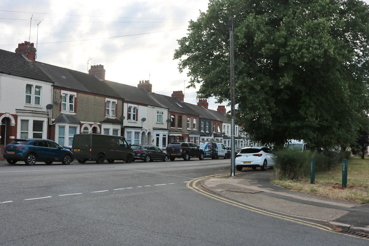

Nowhere in West Northamptonshire broke the nitrogen dioxide limit in 2025. One spot came close: the kerb outside The Cock Inn in Kingsthorpe, at 37.1 µg/m³.
Not one monitoring site in West Northamptonshire broke the legal limit for nitrogen dioxide in 2025. There was one breach in 2024 and one in 2023.
Only a single spot came within 10% of the limit, and it is in Northampton. It is the kerb outside The Cock Inn on Harborough Road, Kingsthorpe, where the tube recorded 37.1 µg/m³ against a limit of 40. In 2022, eleven sites were that close.
The figures are in the council’s Air Quality Annual Status Report for 2026, dated 29 June and since approved by DEFRA. It reports on data collected through 2025. (West Northamptonshire Council, Annual Status Report 2026)
The one that is still being watched
Tube 57, listed as Harborough Road 9, sits on a lamppost at a busy junction outside the pub. The raw 2025 reading was 37.1 µg/m³. Corrected for the distance to the nearest place someone actually lives, it comes down to 36.8. The 10% threshold that keeps a site under review is 36.
That site has not had a clean year in five. Its annual means have ranged from 37.1 to 43.7 µg/m³ since 2021.
The council adds a caveat worth knowing if you live there. The tube is roughly 2.5m up. The pub’s managers’ accommodation is on the first floor, about 4.5m up, where the level is likely to be lower. It cannot put a tube at that height because of the age of the building, and DEFRA’s local authority helpdesk has told it that modelling is not needed for now.
Four pollution zones went in May
An Air Quality Management Area is a boundary a council must draw when it expects the limit to be broken, and it can only be lifted after several clean years. Four were revoked on 13 May 2026, according to DEFRA’s national register:
- Towcester, covering the A5 Watling Street from the Saracens Head crossroads to Silverstone Brook. Declared in 2005
- Victoria Promenade, Northampton, covering Bridge Street, Victoria Promenade and Victoria Gardens including the Plough Hotel. Declared in 2005
- Campbell Square, Northampton, at the Grafton Street and Regent Street junction. Declared in 2009. Its 2025 reading was 29.5 µg/m³
- St Michael’s, Northampton, on St Michael’s Road near the Kettering Road junction. Declared in 2009. Its 2025 reading was 27.9 µg/m³
(DEFRA, AQMA register for West Northamptonshire)
One number in the council’s announcement does not match the register. The release says there were seven such zones “at the start of 2024”. DEFRA’s register shows eight in force on 1 January 2024. Seven is the figure for the start of 2026, after the M1 zone and the A45 zone at Wootton Hall Park were revoked in December 2024 and Bradshaw Street was declared.
The three still standing are all in Northampton
| Zone | Where | Highest 2025 reading |
|---|---|---|
| AQMA 4, Harborough Road | Kingsthorpe Grove, Harborough Road, Cranford Terrace, Alexandra Terrace, Boughton Green Road | 37.1 µg/m³ |
| AQMA Bradshaw Street | Bradshaw Street and part of Sheep Street, by North Gate bus station | 34.5 µg/m³ |
| AQMA 3, St James | St James Road, Weedon Road, Harlestone Road and adjoining streets | 32.3 µg/m³ |
Bradshaw Street is the newest, declared in December 2024. When the council worked out where the pollution there was coming from, the answer was buses and coaches. Everywhere else, the main contributor was diesel cars.
Two of the three are close to going. If Bradshaw Street and St James hold their levels for another twelve months, the council says it will seek to revoke both in 2027. St James has already had three clean years, but is being held for a further year to avoid what the report calls cycling between revocation and declaration.
What is actually shifting the numbers
The council monitored 145 diffusion tube sites across the district in 2025, plus one DEFRA-run automatic station at Spring Park recreation ground. Of the 114 sites with five years of comparable data, 111 (97%) are lower than they were in 2021.
The single biggest fall in the district was not in Northampton at all. It was at 16 London Road in Roade, down 10.4 µg/m³, which the report puts down to the 2.5km bypass that opened around the village in August 2024 as part of the SEGRO rail freight scheme at junction 15 of the M1.
Three sites went up, and both of the notable ones are on the M1 corridor:
- 77 High Street, Collingtree, at 22.9 µg/m³, up 0.7. The tube was moved nearer the motorway
- A45 Wootton, at 22.2 µg/m³, up 1.7, which the report attributes to the junction 15 roadworks
Coming next: 71 zero emission buses, run by Stagecoach Midlands. The report names the routes, and they are the same corridors as the three remaining zones: Harborough Road, Kingsthorpe, St James and North Gate bus station at Bradshaw Street. Daventry and its villages follow from 2027. The report expected the first buses in service in June 2026, and the council marked the launch in August. The fleet is due to be complete by spring 2027.
The council has published two different funding figures for that same fleet, and they do not reconcile. Its launch release of 20 August gives £19.5m from Stagecoach plus £12.6m of government funding, £32.1m in total. The Annual Status Report, written two months earlier, describes a £9.4m ZEBRA 2 grant awarded in March 2024, match funding of up to £21.95m from the operator and a further £2.2m.
And one thing that did not work
The council’s news release does not mention this, but its own report does.
In March 2022 DEFRA gave the council £148,297 to try active traffic management around the Northampton zones. Twenty low cost sensors went up, feeding live readings into the traffic signals, with roadside signs at Kingsthorpe and St James telling drivers to pick another route or switch off their engines.
The review was blunt. The sensor system “has not proved very reliable”, sometimes because of weather and sometimes not, and because the readings are not to reference standard they confused the public. The supplier then introduced a subscription the grant did not cover. The traffic signals themselves need upgrading before they can run the optimisation system properly, and that was not covered either. DEFRA has agreed the leftover money can go on something else, which has not yet been decided.
The 3,000 on-street electric vehicle chargers are behind too. The £2.8m was secured in March 2025, and the report says installation was only anticipated to start in July 2026 because of recruitment problems in the team meant to deliver it.
What it means for you
- If you live on Harborough Road in Kingsthorpe, your street is the last one in the district still close to the limit. The council is keeping the zone in place and reviewing where the tube sits.
- Check your own area. DEFRA’s Check air quality service covers any local area and will send pollution alerts.
- Wood burning matters more than most people think. Domestic burning accounted for 20% of UK fine particle emissions in 2024, close to road transport’s 21%. The council’s advice campaign, The Burning Question, covers fuel choice, servicing and chimney sweeping.
- Nobody measures fine particles here. Neither the council nor DEFRA monitors PM10 in West Northamptonshire, and there is no legal duty on councils to act on PM2.5. The nitrogen dioxide picture is the only one with a legal test behind it.
- Two more zones could go in 2027. That decision rests on the next twelve months of readings at Bradshaw Street and St James.
For what is happening on the roads that carry the traffic, see Northampton roadworks and travel and parking in Northampton.
Sources
- Air Quality Annual Status Report 2026, West Northamptonshire Council, 29 June 2026, reference WNCASR2026 (PDF, 6MB). Source of every reading quoted, the 145 tube sites, the 111 of 114 falling sites, the Roade, Collingtree and Wootton figures, the tube height caveat at The Cock Inn, the electric bus funding and the review of the traffic management project.
- AQMA register for West Northamptonshire, DEFRA. Source of the declaration and revocation dates, including 13 May 2026, and the boundary descriptions.
- Air quality in West Northamptonshire continues to improve, West Northamptonshire Council, 3 September 2026. The council’s own announcement.
- Air quality reports and data, West Northamptonshire Council, read 5 September 2026. Confirms the 2026 report was submitted to DEFRA and approved.
- Year 4 pupil’s artwork helps launch Northampton’s new electric buses, West Northamptonshire Council, 20 August 2026. Source of the £19.5m, £12.6m and £32.1m bus figures and of the August launch.
All readings are annual mean nitrogen dioxide concentrations in micrograms per cubic metre, adjusted as the report describes. The national objective is 40.
Have your say