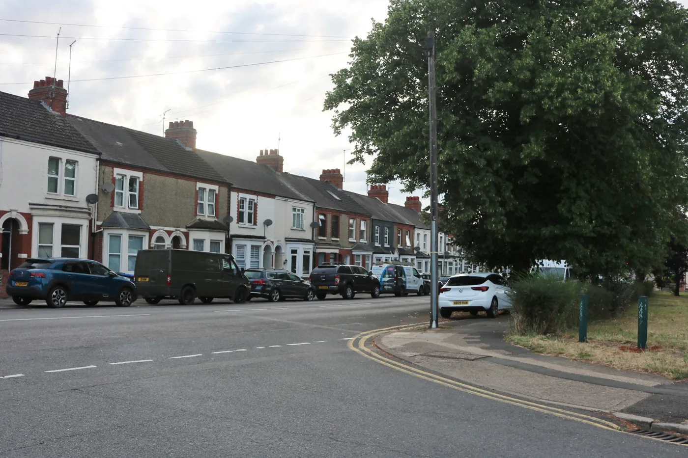

Bus priority on Harborough Road and Kettering Road, park and ride and a path on the old Brackmills railway are in the draft plan. Comments close 15 November.
West Northamptonshire Council wants views on a ten-year plan for getting around Northampton. The draft Northampton Area Transport Strategy names the roads and neighbourhoods it would change first. The survey closes on Sunday 15 November. (West Northamptonshire Council, 29 September 2026)
The council assessed 155 possible schemes and has picked 61 as the highest priority and grouped them into 14 packages. Most focus on walking, cycling and buses. Nothing is funded yet, and “most proposals are at a very early stage of development”, the consultation summary says. (Consultation summary, PDF)
The strategy covers the town and the surrounding villages, about 250,000 people. It runs to 2036 and looks beyond.
What is proposed, area by area
The summary sets out the packages by part of town.
| Area | What the packages include |
|---|---|
| Kettering Road and Moulton | Bus priority and technology on Kettering Road; mobility hubs and park and ride on the A43 corridor towards Moulton, Overstone and Sywell |
| Kingsthorpe, Kings Heath and Boughton | Bus priority on Harborough Road; park and ride and better walking routes in Kingsthorpe; better east-west links between Kings Heath and Moulton Park; traffic management in Moulton and Boughton |
| Brackmills, Weston Favell and the east | Mobility hubs in Southfields, Goldings, Lings, Thorplands, Blackthorn and Rectory Farm; safer crossings on Great Billing Way, Lings Way and Talavera Way; a hub at Weston Favell Shopping Centre; a mostly traffic-free walking and cycling route from the town centre to Brackmills |
| Town centre | A walking zone; public realm work at Abington Square; changes at the Plough junction; retimed ring road signals; a parking plan |
| Upton and the stadiums | A safer cycle route from the station to Sixfields and Upton; mobility hubs at or near Franklin’s Gardens, Sixfields and Edgar Mobbs Way for match days |
| Surrounding villages | Walking and cycling links to Harpole, Little Houghton, Great Houghton, Milton Malsor and Kislingbury; better buses to Wellingborough |
A mobility hub is a place designed for what the summary calls “better interchange between modes”: switching easily between bus, bike and walking.
The council’s FAQ answers the question most drivers will ask. On whether roads will be closed, it says the strategy “does not go into specific details on what each scheme may involve”. That would come later, with more consultation. (Frequently asked questions, PDF)
The old Brackmills railway line: no trains
One document published alongside the strategy settles a long-running question. The council owns the disused railway trackbed from Bridge Street to the county boundary, running past Brackmills and through Great Houghton. The line was dismantled in the 1960s. The study also tested reopening it as a railway to Bedford.
Consultants Pell Frischmann assessed nine options for it. Rail and bus came bottom. (Brackmills Options Assessment Report, PDF)
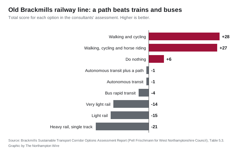
The report gives three main reasons against rail and buses:
- the tunnel at Great Houghton is too low for buses or trains without replacement structures
- buses would have nowhere to turn round on the narrow trackbed
- a railway to Bedford would need land that has since been built on, including housing at Olney and a former station site, so compulsory purchase would be likely
It also compares rough building costs per kilometre:
| Option | Indicative cost per km |
|---|---|
| Greenway path | £1.2 million |
| Bus rapid transit (guided busway) | £7.24 million |
| Very light rail | £10 million |
| Light rail | £20 million to £30 million |
| Single-track railway | £100 million |
| Double-track railway | £200 million |
The recommendation is a walking and cycling route, possibly with space for horse riders, with room kept for other uses later. It would connect with the town centre to Brackmills route in the strategy. The report is not a decision. The council has published it “for information and transparency purposes” and is not asking for comments on it.
Parking
A separate AECOM parking study was also published for information. It looked at 18 council car parks and forecasts future demand as the town grows. The FAQ is direct about that: “some parking spaces will be removed so that regeneration proposals can take place”. The council says it will make sure the remaining spaces are used efficiently, with better signs and technology to help drivers find a free space. (Northampton Car Parking Demand and Capacity Study, PDF)
For the car parks already shut or losing spaces this autumn, see our Northampton roadworks and travel page.
What it means for you
- You can respond until 23:59 on Sunday 15 November using the online survey. You do not have to answer every question.
- Read the short summary first. The council says it has “everything in it that you need to be able to respond”. The full strategy and appendices are there if you want the detail.
- Two online drop-in sessions run on Microsoft Teams: 19 October, 2pm to 3.30pm, and 20 October, 3pm to 4.30pm. Email localtransportplan@westnorthants.gov.uk for the link.
- If you use Harborough Road or Kettering Road, these are the two corridors named for bus priority, so they are the ones most likely to change first.
- Nothing is decided. The council plans to take a final version to Cabinet in spring 2027. Some schemes from its existing cycling and walking plan and bus improvement plan are already being progressed.
The Local Plan consultation is due to open separately by 5 October. The council says the two documents are being kept consistent. Our latest on the plan is here.
Sources
- Residents invited to help shape Northampton’s future transport network, West Northamptonshire Council, 29 September 2026
- Northampton Area Transport Strategy: have your say, consultation page, opened 28 September 2026
- Draft Northampton Area Transport Strategy: consultation summary (PDF)
- Frequently asked questions (PDF)
- Brackmills Sustainable Transport Corridor Options Assessment Report, Pell Frischmann for West Northamptonshire Council (PDF)
- Northampton Car Parking Demand and Capacity Study, AECOM for West Northamptonshire Council (PDF)
Have your say